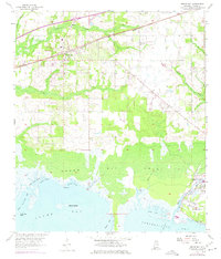
1958 Map of Grand Bay
USGS Topo · Published 1975About this map
The coastal lowlands of Mobile County meet the Gulf of Mexico in this mid-century survey, defined by the extensive Grand Bay Swamp and a network of tidal waterways. The settlement of Grand Bay serves as a primary inland hub, situated along the Louisville and Nashville railroad and home to the Grand Bay Cem. To the east, the rural community of Fernland is identified near several sandpits, while the St Elmo Landing Field sits on the northern edge of the quadrangle, reflecting the region's mid-century aviation infrastructure.
Find a feature on this map
28 named features on this map. Tap any name to fly to it.
Don’t see what you’re looking for? This feature index may not catch every label — zoom into the map to look around manually.
Map Details
Editions of this 1958 Grand Bay Map
3 editions found
Other maps of this area

1921 · Grand Bay
USGS Topo · 1:62,500

1921 · Delchamps
USGS Topo · 1:62,500

1922 · Mobile
USGS Topo · 1:62,500

1940 · Mobile
USGS Topo · 1:62,500

1941 · Cedar Point
USGS Topo · 1:62,500

1941 · Hurley
USGS Topo · 1:62,500

1942 · Theodore
USGS Topo · 1:31,680

1943 · Cedar Point
USGS Topo · 1:62,500

1943 · Theodore
USGS Topo · 1:31,680

1943 · Grand Bay
USGS Topo · 1:62,500