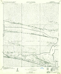
1935 Map of Grand Chenier
USGS Topo · Published 1958About this map
Grand Cheniere Ridge and Little Cheniere Ridge dominate this coastal landscape, providing elevated ground for settlement amidst the expansive wetlands of Drainage District No 2. Along these narrow ridges, the community of Grand Cheniere stretches parallel to the winding Mermentau River, while the smaller settlement of Premo sits further north. The map documents the critical infrastructure of the mid-1930s, including the Grand Cheniere Ferry and educational and religious hubs like the Grand Cheniere Sch and Little Cheniere Ch.
Find a feature on this map
21 named features on this map. Tap any name to fly to it.
Don’t see what you’re looking for? This feature index may not catch every label — zoom into the map to look around manually.
Map Details
Editions of this 1935 Grand Chenier Map
2 editions found
Other maps of this area

1934 · Catfish Lake
USGS Topo · 1:24,000

1934 · Lake Misere
USGS Topo · 1:24,000

1934 · Boudreaux Lake
USGS Topo · 1:24,000

1934 · Latania Lake
USGS Topo · 1:24,000

1935 · Lake Misere
USGS Topo · 1:31,680

1935 · Catfish Lake
USGS Topo · 1:31,680

1935 · Latania Lake
USGS Topo · 1:31,680

1935 · Boudreaux Lake
USGS Topo · 1:31,680

1935 · Bay Labauve
USGS Topo · 1:31,680

1935 · Grand Chenier
USGS Topo · 1:31,680