
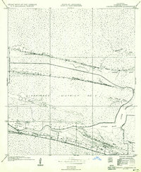
1935 Map of Grand Chenier
USGS Topo · Published 1935About this map
The low-lying marshes of Cameron Parish are defined here by a series of narrow, habitable elevations known as chenieres, which supported isolated communities in the mid-1930s. The long, slender Grand Cheniere Ridge serves as the primary corridor for settlement, hosting the Grand Cheniere Sch and providing access to the Mermentau River via the Grand Cheniere Ferry. To the north, more remote ribbons of high ground like Little Cheniere Ridge and the Cheniere Perdue Ridge rise above the wetlands of Drainage District No 2. This survey, compiled in part from early aerial photography, illustrates a landscape where life was inextricably linked to the tides and water levels of Upper Mud Lake and the various bayous, such as Little Cheniere Bayou and Pumpkin Bayou, that weave through the coastal prairie.
Find a feature on this map
20 named features on this map. Tap any name to fly to it.
Don’t see what you’re looking for? This feature index may not catch every label — zoom into the map to look around manually.
Map Details
Editions of this 1935 Grand Chenier Map
2 editions found
Other maps of this area

1934 · Catfish Lake
USGS Topo · 1:24,000

1934 · Lake Misere
USGS Topo · 1:24,000

1934 · Boudreaux Lake
USGS Topo · 1:24,000

1934 · Latania Lake
USGS Topo · 1:24,000

1935 · Lake Misere
USGS Topo · 1:31,680

1935 · Catfish Lake
USGS Topo · 1:31,680

1935 · Latania Lake
USGS Topo · 1:31,680

1935 · Boudreaux Lake
USGS Topo · 1:31,680

1935 · Bay Labauve
USGS Topo · 1:31,680

1946 · Hog Bayou NE
USGS Topo · 1:31,680