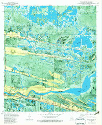
1980 Map of Grand Chenier
USGS Topo · Published 1983About this map
The Mermentau River winds through this coastal Louisiana landscape, defining a network of ridges and marshes that have long dictated local settlement. This orthophotomap, based on 1974 aerial photography and 1978 surveys, illustrates the unique geography of the region, where linear oak-covered ridges—or cheniers—provide the only elevated ground for homes, roads, and cemeteries. Along Grand Chenier Ridge, the community of Grand Chenier is anchored by the Grand Chenier Sch and various family burial grounds including Shady Oaks Cem and McCall Cem.
Find a feature on this map
35 named features on this map. Tap any name to fly to it.
Don’t see what you’re looking for? This feature index may not catch every label — zoom into the map to look around manually.
Map Details
Editions of this 1980 Grand Chenier Map
2 editions found
Other maps of this area

1934 · Catfish Lake
USGS Topo · 1:24,000

1934 · Lake Misere
USGS Topo · 1:24,000

1934 · Boudreaux Lake
USGS Topo · 1:24,000

1934 · Latania Lake
USGS Topo · 1:24,000

1935 · Lake Misere
USGS Topo · 1:31,680

1935 · Catfish Lake
USGS Topo · 1:31,680

1935 · Latania Lake
USGS Topo · 1:31,680

1935 · Boudreaux Lake
USGS Topo · 1:31,680

1935 · Bay Labauve
USGS Topo · 1:31,680

1935 · Grand Chenier
USGS Topo · 1:31,680