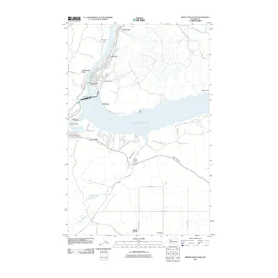
2011 Map of Grand Coulee Dam
USGS Topo · Published 2011About this map
The monumental infrastructure of the Grand Coulee Dam anchors this 2011 survey, showing the complex interplay between the Columbia River and the massive reservoir of Franklin D Roosevelt Lake. The map details the clusters of development that grew around the dam's construction and operation, including the incorporated communities of Grand Coulee, Coulee Dam, and Elmer City. Portions of the Colville Indian Reservation appear in the northern section, while the southern landscape is defined by the unique geology of Rattlesnake Canyon and Spring Canyon. Local landmarks like the Coulee Dam Seaplane Base and the Grand Coulee Grange highlight the area's specialized transportation and community hubs. The cartography also traces the canyon roads and vistas, such as Crown Point Vista, which provide vantage points over the harnessed river valley.
Find a feature on this map
44 named features on this map. Tap any name to fly to it.
Don’t see what you’re looking for? This feature index may not catch every label — zoom into the map to look around manually.
Map Details
Editions of this 2011 Grand Coulee Dam Map
This is the sole edition of this map. No revisions or reprints were ever made.
Other maps of this area

1948 · Grand Coulee Dam
USGS Topo · 1:62,500

1950 · Grand Coulee Dam
USGS Topo · 1:62,500

1950 · Nespelem
USGS Topo · 1:62,500

1950 · Alameda Flat
USGS Topo · 1:62,500

1952 · Alameda Flat
USGS Topo · 1:62,500

1953 · Ritzville
USGS Topo · 1:250,000

1954 · Okanogan
USGS Topo · 1:250,000

1958 · Okanogan
USGS Topo · 1:250,000

1959 · Ritzville
USGS Topo · 1:250,000

1965 · Ritzville
USGS Topo · 1:250,000