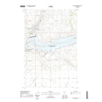
2020 Map of Grand Coulee Dam
USGS Topo · Published 2020About this map
The massive engineering of the Grand Coulee Dam anchors this landscape, where the Columbia River is impounded to form Franklin D Roosevelt Lake. The surrounding area is part of the Lake Roosevelt National Recreation Area, featuring a complex shoreline of inlets like Crescent Bay, Eden Harbor, and Gibbs Bay. On the high ground above the dam, the town of Grand Coulee and the settlement of Coulee Dam serve as the primary population centers, alongside the historic residential layout of Mason City. The map reveals the dramatic transition from the plateau of Washington Flats down to the carved coulees and draws such as Seaton Canyon and Klobuschar Draw. To the northwest, Crown Point Vista provides a vantage over the river's bend, while the north-south canyon geography is further defined by Hells Canyon and the high point of Sand Hill.
Find a feature on this map
67 named features on this map. Tap any name to fly to it.
Don’t see what you’re looking for? This feature index may not catch every label — zoom into the map to look around manually.
Map Details
Editions of this 2020 Grand Coulee Dam Map
This is the sole edition of this map. No revisions or reprints were ever made.
Other maps of this area

1948 · Grand Coulee Dam
USGS Topo · 1:62,500

1950 · Grand Coulee Dam
USGS Topo · 1:62,500

1950 · Nespelem
USGS Topo · 1:62,500

1950 · Alameda Flat
USGS Topo · 1:62,500

1952 · Alameda Flat
USGS Topo · 1:62,500

1953 · Ritzville
USGS Topo · 1:250,000

1954 · Okanogan
USGS Topo · 1:250,000

1958 · Okanogan
USGS Topo · 1:250,000

1959 · Ritzville
USGS Topo · 1:250,000

1965 · Ritzville
USGS Topo · 1:250,000