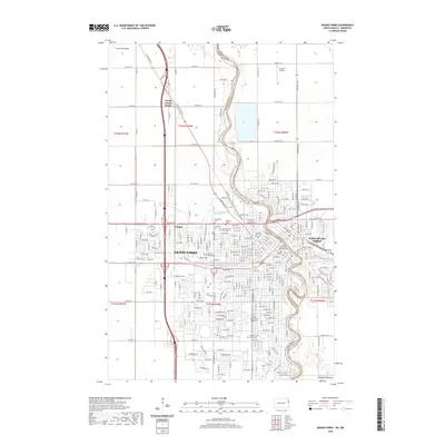
2020 Map of Grand Forks
USGS Topo · Published 2020About this map
Grand Forks and East Grand Forks occupy the heart of this Red River Valley map, straddling the winding border between North Dakota and Minnesota. The urban landscape is anchored by the University of North Dakota and the Grand Forks County Courthouse, showing the dense grid of residential streets and commercial corridors like DeMers Ave and Gateway Dr. The meandering Red River of the N and its tributary, the Red Lake River, define the physical geography and the state line, while the English Coulee cuts through the western portion of the city.
Find a feature on this map
176 named features on this map. Tap any name to fly to it.
Don’t see what you’re looking for? This feature index may not catch every label — zoom into the map to look around manually.
Map Details
Editions of this 2020 Grand Forks Map
This is the sole edition of this map. No revisions or reprints were ever made.
Other maps of this area

1918 · Warren
USGS Topo · 1:62,500

1934 · Grand Forks
USGS Topo · 1:24,000

1934 · Grand Forks
USGS Topo · 1:62,500

1938 · Grand Forks
USGS Topo · 1:62,500

1952 · Grand Forks
USGS Topo · 1:250,000

1952 · Thief River Falls
USGS Topo · 1:250,000

1955 · Warren
USGS Topo · 1:62,500

1956 · Thief River Falls
USGS Topo · 1:250,000

1956 · Grand Forks
USGS Topo · 1:250,000

1957 · Thief River Falls
USGS Topo · 1:250,000