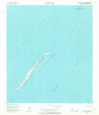
1951 Map of Grand Gosier Islands
USGS Topo · Published 1980About this map
Breton National Wildlife Refuge encompasses the fragile arc of the Grand Gosier Islands as they stood in the early 1950s. This survey, compiled from aerial photography and planetable fieldwork, documents the shifting coastal morphology of Plaquemines Parish before decades of erosion and tropical storms altered these landforms. The map captures the interface between the Gulf of Mexico and Breton Sound, revealing the extensive Shallow Area and navigational hazards like Myth Shoal and the northern Errol Islands. As a part of the greater Chandeleur Islands chain, these features served as critical habitat and natural barriers. The detail provided, including specific locations of breakers and shoals, provides an essential baseline for environmental historians and researchers studying the long-term changes of the Louisiana coastline.
Find a feature on this map
11 named features on this map. Tap any name to fly to it.
Don’t see what you’re looking for? This feature index may not catch every label — zoom into the map to look around manually.
Map Details
Editions of this 1951 Grand Gosier Islands Map
2 editions found
Other maps of this area
1951 · Stake Islands
USGS Topo · 1:24,000
1951 · Grand Gosier Islands
USGS Topo · 1:24,000

1953 · Breton Island
USGS Topo · 1:62,500

1957 · Breton Sound
USGS Topo · 1:250,000
1958 · Breton Island
USGS Topo · 1:62,500

1961 · Breton Sound
USGS Topo · 1:250,000

1982 · North Islands
USGS Topo · 1:100,000
1983 · Black Bay
USGS Topo · 1:100,000
1983 · Mississippi River Delta
USGS Topo · 1:100,000
1998 · Grand Gosier Islands
USGS Topo · 1:24,000