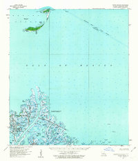
1958 Map of Breton Island
USGS Topo · Published 1963About this map
Breton National Wildlife Refuge and the Delta National Wildlife Refuge dominate this coastal landscape, capturing the intricate deltaic transition between the Gulf of Mexico and Breton Sound. In the late 1950s, this region was a critical intersection of conservation and industrial expansion. The map shows the Mississippi River Gulf Outlet Channel under construction, a massive engineering project designed to provide a shorter shipping route to New Orleans.
Find a feature on this map
54 named features on this map. Tap any name to fly to it.
Don’t see what you’re looking for? This feature index may not catch every label — zoom into the map to look around manually.
Map Details
Editions of this 1958 Breton Island Map
3 editions found
Other maps of this area

1893 · East Delta
USGS Topo · 1:62,500

1893 · La Fortuna
USGS Topo · 1:62,500

1893 · Forts
USGS Topo · 1:62,500

1893 · West Delta
USGS Topo · 1:62,500

1935 · Taylor Pass
USGS Topo · 1:31,680

1947 · Pass A Loutre West
USGS Topo · 1:31,680

1947 · Venice
USGS Topo · 1:31,680

1947 · Main Pass
USGS Topo · 1:31,680

1947 · Pass A Loutre East
USGS Topo · 1:31,680

1948 · Forts
USGS Topo · 1:62,500