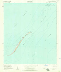
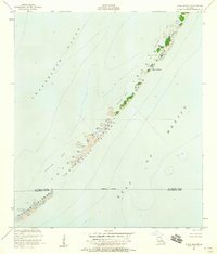
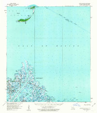
1951 Map of Grand Gosier Islands
USGS Topo · Published 1975About this map
Grand Gosier Island and its surrounding waters define this coastal survey of the Plaquemines Parish coastline. Much of the land area is designated as the Breton National Wildlife Refuge, reflecting its status as a critical sanctuary for migratory birds and marine life. The map illustrates the fragile geography of the Chandeleur Islands chain where it meets the open Gulf of Mexico. Navigation and maritime history are highlighted through the documentation of submerged hazards and changing seafloors, including Errol Shoal, Myth Shoal, and extensive Shallow Areas. Compiled from aerial photography and planetable surveys in the early 1950s, the map serves as a vital record of the barrier island's configuration before decades of storm erosion and coastal change. It captures the boundary between the relatively protected Breton Sound and the high-energy environment of the outer gulf.
Find a feature on this map
8 named features on this map. Tap any name to fly to it.
Don’t see what you’re looking for? This feature index may not catch every label — zoom into the map to look around manually.
Map Details
Editions of this 1951 Grand Gosier Islands Map
2 editions found

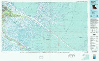
Other maps of this area
1951 · Stake Islands
USGS Topo · 1:24,000

1953 · Breton Island
USGS Topo · 1:62,500

1957 · Breton Sound
USGS Topo · 1:250,000
1958 · Breton Island
USGS Topo · 1:62,500

1961 · Breton Sound
USGS Topo · 1:250,000

1982 · North Islands
USGS Topo · 1:100,000
1983 · Black Bay
USGS Topo · 1:100,000

1983 · Mississippi River Delta
USGS Topo · 1:100,000

1998 · Grand Gosier Islands
USGS Topo · 1:24,000

2012 · Grand Gosier Islands
USGS Topo · 1:24,000