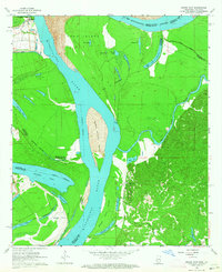
1963 Map of Grand Gulf
USGS Topo · Published 1964About this map
Grand Gulf and its storied landscape are defined by the shifting course of the Mississippi River, which separates Claiborne County, Mississippi, from the parishes of Louisiana. This 1963 survey documents a complex network of oxbow lakes and islands, including Yucatan Lake, Palmyra Lake, and the prominent Middle Ground Island. The area's deep ties to Civil War history are marked by the Grand Gulf Military Monument, situated near the riverbanks where an Old Railroad grade still traces the terrain toward the interior.
Find a feature on this map
37 named features on this map. Tap any name to fly to it.
Don’t see what you’re looking for? This feature index may not catch every label — zoom into the map to look around manually.
Map Details
Editions of this 1963 Grand Gulf Map
3 editions found
Other maps of this area

1909 · Lake Bruen
USGS Topo · 1:24,000

1939 · Yokena
USGS Topo · 1:62,500

1939 · Lorman
USGS Topo · 1:62,500

1953 · Natchez
USGS Topo · 1:250,000

1955 · Jackson
USGS Topo · 1:250,000

1956 · Natchez
USGS Topo · 1:250,000

1958 · St. Joseph
USGS Topo · 1:62,500

1959 · Natchez
USGS Topo · 1:250,000

1961 · Jackson
USGS Topo · 1:250,000

1962 · Jackson
USGS Topo · 1:250,000