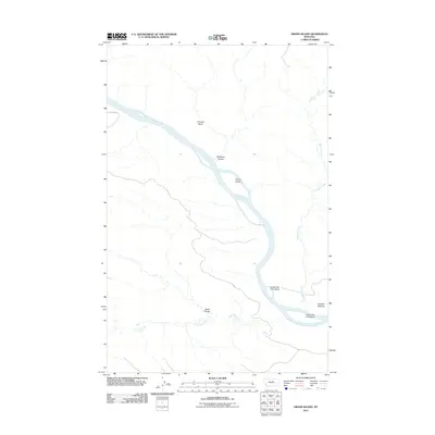
2011 Map of Grand Island
USGS Topo · Published 2011About this map
The Missouri River dominates this Fergus County landscape, cutting a wide path through northern Montana's riverbreaks. This survey captures a significant stretch of the waterway where distinct features like Grand Island, Upper Two Calf Island, and Lower Two Calf Island emerge from the channel. The surrounding terrain is marked by deep drainage patterns and elevation changes, evidenced by landmarks such as Fortress Butte and the winding paths of Hideaway Coulee and Reed Coulee.
Find a feature on this map
12 named features on this map. Tap any name to fly to it.
Don’t see what you’re looking for? This feature index may not catch every label — zoom into the map to look around manually.
Map Details
Editions of this 2011 Grand Island Map
This is the sole edition of this map. No revisions or reprints were ever made.
Other maps of this area

1943 · Landusky
USGS Topo · 1:125,000

1954 · Cow Island
USGS Topo · 1:24,000

1954 · Hessler Ridge
USGS Topo · 1:24,000

1954 · Baker Monument
USGS Topo · 1:24,000

1954 · Bell Ridge West
USGS Topo · 1:24,000

1954 · Grand Island
USGS Topo · 1:24,000

1954 · Lewistown
USGS Topo · 1:250,000

1959 · Lewistown
USGS Topo · 1:250,000
1971 · D Y Junction
USGS Topo · 1:24,000
1971 · Shetland Divide
USGS Topo · 1:24,000