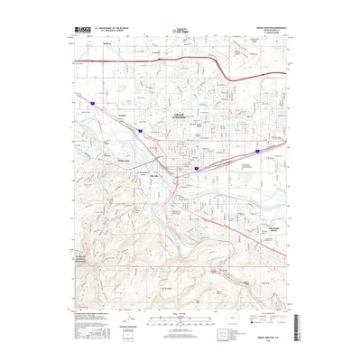
2016 Map of Grand Junction
USGS Topo · Published 2016About this map
The confluence of the Colorado River and Gunnison River anchors this study of the High Desert landscape in western Colorado. The city of Grand Junction is shown in high detail, from the Grand Junction Regional Airport in the northeast to the sprawling campus of Colorado Mesa Univ. The map reveals a sophisticated hydraulic network essential for agriculture and power in this arid region, including the Government Highline Canal, the Independent-Ranchmens-Ditch, and the Orchard Mesa Canal Number 1.
Find a feature on this map
73 named features on this map. Tap any name to fly to it.
Don’t see what you’re looking for? This feature index may not catch every label — zoom into the map to look around manually.
Map Details
Editions of this 2016 Grand Junction Map
This is the sole edition of this map. No revisions or reprints were ever made.
Other maps of this area

1934 · Colorado National Monument
USGS Topo · 1:24,000

1956 · Moab
USGS Topo · 1:250,000

1956 · Grand Junction
USGS Topo · 1:250,000

1959 · Grand Junction
USGS Topo · 1:250,000

1959 · Moab
USGS Topo · 1:250,000

1960 · Moab
USGS Topo · 1:250,000

1960 · Grand Junction
USGS Topo · 1:250,000

1962 · Moab
USGS Topo · 1:250,000

1962 · Grand Junction
USGS Topo · 1:250,000

1962 · Fruita
USGS Topo · 1:24,000