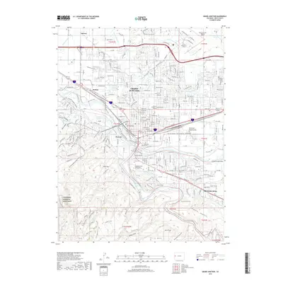
2019 Map of Grand Junction
USGS Topo · Published 2019About this map
Grand Junction serves as the hub of the Grand Valley, situated at the confluence where the Gunnison River joins the Colorado River. This modern survey illustrates the complex water management system vital to the region, including the Grand Valley Canal, The Redlands Power Canal, and multiple segments of the Orchard Mesa Canal Number 1. The map details the transition from the urban center to the protected wilderness of the Colorado National Monument in the southwest, marked by dramatic features like Red Canyon and No Thoroughfare Canyon. Local history and genealogy are well-represented by several large interment sites, including the Independent Order of Odd Fellows and Masonic Cem and The Veterans Memorial Cem of Western Colorado, alongside institutional landmarks like Colorado Mesa University.
Find a feature on this map
63 named features on this map. Tap any name to fly to it.
Don’t see what you’re looking for? This feature index may not catch every label — zoom into the map to look around manually.
Map Details
Editions of this 2019 Grand Junction Map
This is the sole edition of this map. No revisions or reprints were ever made.
Other maps of this area

1934 · Colorado National Monument
USGS Topo · 1:24,000

1956 · Moab
USGS Topo · 1:250,000

1956 · Grand Junction
USGS Topo · 1:250,000

1959 · Grand Junction
USGS Topo · 1:250,000

1959 · Moab
USGS Topo · 1:250,000

1960 · Moab
USGS Topo · 1:250,000

1960 · Grand Junction
USGS Topo · 1:250,000

1962 · Moab
USGS Topo · 1:250,000

1962 · Grand Junction
USGS Topo · 1:250,000

1962 · Fruita
USGS Topo · 1:24,000