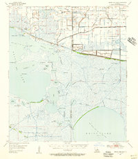
1955 Map of Grand Lake East
USGS Topo · Published 1956About this map
Intracoastal Waterway traffic and industrial extraction define this coastal Louisiana landscape during the mid-1950s. The map illustrates a complex network of man-made channels and natural bayous, including the Gueydan Canal and Blackfish Canal, which cut through the extensive Maple Marsh. This era shows the expansion of energy infrastructure with numerous Gas Wells and the established Grand Lake Oil and Gas Field alongside the Pecan Lake Gas Field.
Find a feature on this map
67 named features on this map. Tap any name to fly to it.
Don’t see what you’re looking for? This feature index may not catch every label — zoom into the map to look around manually.
Map Details
Editions of this 1955 Grand Lake East Map
3 editions found
Other maps of this area

1932 · Constance Bayou NE
USGS Topo · 1:31,680

1932 · Constance Bayou NW
USGS Topo · 1:31,680

1934 · Catfish Lake
USGS Topo · 1:24,000

1934 · Latania Lake
USGS Topo · 1:24,000

1935 · Catfish Lake
USGS Topo · 1:31,680

1935 · Latania Lake
USGS Topo · 1:31,680

1945 · Pecan Island NW
USGS Topo · 1:31,680

1946 · Morse
USGS Topo · 1:31,680

1946 · Hog Bayou NE
USGS Topo · 1:31,680

1946 · Lake Arthur
USGS Topo · 1:31,680