
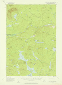
1954 Map of Grand Lake Seboeis
USGS Topo · Published 1958About this map
The Aroostook River winds through the northern portion of this 1950s Maine wilderness, characterized by the organized township-and-range system of the West Branch of the Penobscot and Kennebec River Survey (WELS). This remote landscape is defined by its logging and sporting heritage, as evidenced by a dense network of seasonal dwellings and work sites like Hart Camp, Whipple Camp, and Chase Camp. The vast Grand Lake Seboeis dominates the southern quadrant, serving as a central hub for the region's interconnected waterways, including the West Branch Coombs Brook and La Romkeag Stream. Topographical landmarks such as Chandler Mountain and Wadleigh Mtn provide vertical relief, while the presence of the Cunningham Mine and a Lookout Tower on Spoon Mtn hint at the mid-century industrial and conservation activities in this part of Aroostook and Penobscot Counties.
Find a feature on this map
106 named features on this map. Tap any name to fly to it.
Don’t see what you’re looking for? This feature index may not catch every label — zoom into the map to look around manually.
Map Details
Editions of this 1954 Grand Lake Seboeis Map
3 editions found
Other maps of this area

1930 · Greenlaw
USGS Topo · 1:48,000

1931 · Ashland
USGS Topo · 1:48,000

1931 · Mooseleuk Lake
USGS Topo · 1:48,000

1933 · Greenlaw
USGS Topo · 1:62,500

1934 · Ashland
USGS Topo · 1:62,500

1935 · Mooseleuk Lake
USGS Topo · 1:62,500

1940 · Island Falls
USGS Topo · 1:62,500

1940 · Oxbow
USGS Topo · 1:62,500

1942 · Island Falls
USGS Topo · 1:62,500

1942 · Oxbow
USGS Topo · 1:62,500