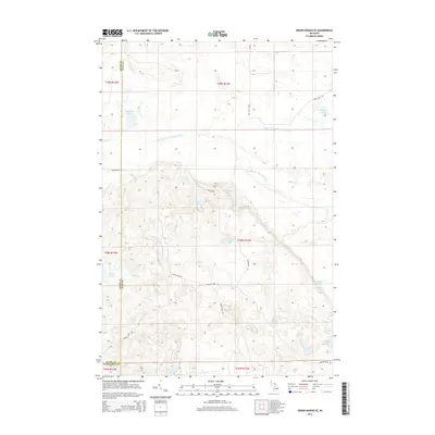
2014 Map of Grand Marais SE
USGS Topo · Published 2014About this map
The North Br Two Hearted River and West Br Two Hearted River dominate this portion of the Lake Superior watershed in Michigan’s Upper Peninsula. This 2014 survey documents a landscape defined by glacial hydrology, where a dense network of isolated basins like Dillingham Lake, Martindale Lake, and Potters Lake dot the forested interior. The topography is etched by seasonal watercourses and swampy depressions, including the Marsh Lakes along the southern border.
Find a feature on this map
30 named features on this map. Tap any name to fly to it.
Don’t see what you’re looking for? This feature index may not catch every label — zoom into the map to look around manually.
Map Details
Editions of this 2014 Grand Marais SE Map
This is the sole edition of this map. No revisions or reprints were ever made.
Other maps of this area

1931 · Seney NW
USGS Topo · 1:31,680

1954 · Sault Sainte Marie
USGS Topo · 1:250,000

1956 · Sault Sainte Marie
USGS Topo · 1:250,000

1957 · Sault Sainte Marie
USGS Topo · 1:250,000

1958 · Sault Sainte Marie
USGS Topo · 1:250,000
1968 · Nawakwa Lake
USGS Topo · 1:24,000

1968 · Muskallonge Lake SW
USGS Topo · 1:24,000

1968 · Muskallonge Lake West
USGS Topo · 1:24,000
1968 · Grand Marais SE
USGS Topo · 1:24,000
1968 · Grand Marais
USGS Topo · 1:24,000