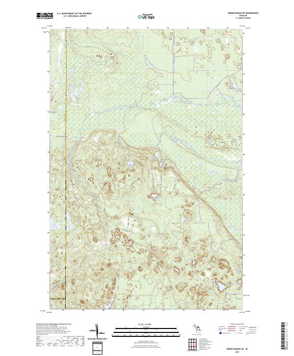
2023 Map of Grand Marais SE
USGS Topo · Published 2023About this map
The North Branch Two Hearted River and West Branch Two Hearted River dominate this portion of the Upper Peninsula, cutting through a landscape defined by extensive wetland networks and isolated water bodies. These river systems are central to the geography of eastern Luce County, where the terrain transitions across township lines from T47N R13W to T49N R12W. The presence of McCloud Grade and Carlson Camp Rd indicates a history of localized access, likely tied to the region's timber heritage and seasonal camps. Scattered across the wilderness are numerous family-named or descriptive lakes, such as Potters Lake, Dillingham Lake, and the connected Wheeler Lake and South Wheeler Lake. This 2023 survey provides a contemporary look at the complex hydrology of the area, including the remote Barfield Lakes and the drainage patterns near Stellwagon Rd.
Find a feature on this map
32 named features on this map. Tap any name to fly to it.
Don’t see what you’re looking for? This feature index may not catch every label — zoom into the map to look around manually.
Map Details
Editions of this 2023 Grand Marais SE Map
This is the sole edition of this map. No revisions or reprints were ever made.
Other maps of this area

1931 · Seney NW
USGS Topo · 1:31,680

1954 · Sault Sainte Marie
USGS Topo · 1:250,000

1956 · Sault Sainte Marie
USGS Topo · 1:250,000

1957 · Sault Sainte Marie
USGS Topo · 1:250,000

1958 · Sault Sainte Marie
USGS Topo · 1:250,000
1968 · Nawakwa Lake
USGS Topo · 1:24,000

1968 · Muskallonge Lake SW
USGS Topo · 1:24,000

1968 · Muskallonge Lake West
USGS Topo · 1:24,000
1968 · Grand Marais SE
USGS Topo · 1:24,000
1968 · Grand Marais
USGS Topo · 1:24,000