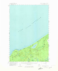
1958 Map of Grand Portal Point
USGS Topo · Published 1974About this map
Grand Portal Point and the towering formations of Pictured Rocks dominate this coastal survey along the southern shore of Lake Superior. The interior landscape within the Hiawatha National Forest is defined by a dense network of glacial lakes and dramatic water features, including Spray Falls, Mosquito Falls, and Chapel Falls. This 1950s data, updated for a 1970s publication, reveals a wilderness largely shaped by its hydrology, where names like Beaver Lake, Trappers Lake, and Sevenmile Lake suggest a history of early woodsmen and seasonal activity. A Lookout Tower near Buck Lake serves as a primary man-made landmark in this wooded expanse, which straddles the border between Alger County and Schoolcraft County. The map provides specific detail for hikers and historians tracing the original forest trails and drainage patterns of the Mosquito River and Spray Creek.
Find a feature on this map
41 named features on this map. Tap any name to fly to it.
Don’t see what you’re looking for? This feature index may not catch every label — zoom into the map to look around manually.
Map Details
Editions of this 1958 Grand Portal Point Map
2 editions found
Other maps of this area

1931 · Shingleton NE
USGS Topo · 1:31,680

1931 · Driggs Lake NW
USGS Topo · 1:31,680

1958 · Munising
USGS Topo · 1:62,500

1958 · Wood Island
USGS Topo · 1:62,500

1958 · Shingleton
USGS Topo · 1:62,500

1958 · Grand Portal Point
USGS Topo · 1:62,500

1958 · Marquette
USGS Topo · 1:250,000

1960 · Marquette
USGS Topo · 1:250,000

1961 · Marquette
USGS Topo · 1:250,000
1966 · Au Sable Point
USGS Topo · 1:24,000