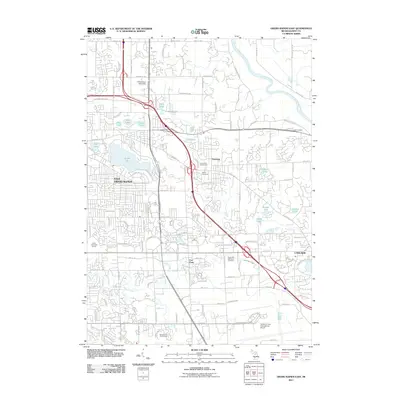
2011 Map of Grand Rapids East
USGS Topo · Published 2011About this map
East Grand Rapids and its surrounding suburbs appear in high detail during this early 21st-century period of established residential growth and infrastructure. The landscape is defined by its numerous glacial lakes, ranging from the prominent Reeds Lake to smaller water bodies like Fisk Lake, Church Lake, and Walden Lake. The development of the era is evident in the dense street networks and the presence of Cornerstone University in the north and the expansive Gerald R. Ford International Airport in the south.
Find a feature on this map
55 named features on this map. Tap any name to fly to it.
Don’t see what you’re looking for? This feature index may not catch every label — zoom into the map to look around manually.
Map Details
Editions of this 2011 Grand Rapids East Map
This is the sole edition of this map. No revisions or reprints were ever made.
Other maps of this area

1914 · Grand Rapids
USGS Topo · 1:62,500

1918 · Cedar Springs
USGS Topo · 1:62,500

1918 · Lowell
USGS Topo · 1:62,500

1943 · Cedar Springs
USGS Topo · 1:62,500

1943 · Grand Rapids
USGS Topo · 1:62,500

1943 · Lowell
USGS Topo · 1:62,500

1954 · Midland
USGS Topo · 1:250,000

1958 · Midland
USGS Topo · 1:250,000

1958 · Grand Rapids
USGS Topo · 1:250,000

1959 · Midland
USGS Topo · 1:250,000