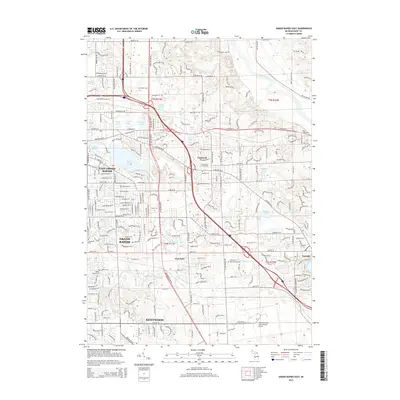
2014 Map of Grand Rapids East
USGS Topo · Published 2014About this map
East Grand Rapids and the expanding suburbs east of Grand Rapids define this 2014 landscape, centered on the recreational and residential hub around Reeds Lake. The area's educational and institutional footprint is visible through the campuses of Calvin Coll and Cornerstone Univ, while its modern transit infrastructure is anchored by the Gerald R. Ford International Airport in the south. The transition from established neighborhoods to peripheral developments like Eastmont and Cascade is marked by numerous historic burial sites, including Woodlawn Cem and the Graceland Mausoleum. Waterways such as the Grand River in the north and the Thornapple River in the east provide natural boundaries for the dense road network connecting East Paris and Kentwood.
Find a feature on this map
62 named features on this map. Tap any name to fly to it.
Don’t see what you’re looking for? This feature index may not catch every label — zoom into the map to look around manually.
Map Details
Editions of this 2014 Grand Rapids East Map
This is the sole edition of this map. No revisions or reprints were ever made.
Other maps of this area

1914 · Grand Rapids
USGS Topo · 1:62,500

1918 · Cedar Springs
USGS Topo · 1:62,500

1918 · Lowell
USGS Topo · 1:62,500

1943 · Cedar Springs
USGS Topo · 1:62,500

1943 · Grand Rapids
USGS Topo · 1:62,500

1943 · Lowell
USGS Topo · 1:62,500

1954 · Midland
USGS Topo · 1:250,000

1958 · Midland
USGS Topo · 1:250,000

1958 · Grand Rapids
USGS Topo · 1:250,000

1959 · Midland
USGS Topo · 1:250,000