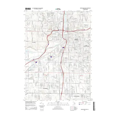
2014 Map of Grand Rapids West
USGS Topo · Published 2014About this map
The Grand River carves a deep southwest-to-northeast path through this urban landscape, anchoring the development of Grand Rapids and its surrounding communities. By the early 21st century, the metropolitan area shows a dense grid of residential and commercial corridors, connecting the city center to Walker, Wyoming, and Grandville. The map reveals a high concentration of established local institutions, particularly academic and religious landmarks. Higher education is represented by campuses for Grand Rapids Community College, Aquinas College, and Grace Bible College. Genealogists will find this sheet especially valuable for its preservation of numerous burial grounds, ranging from the central Fulton Street Cemetery and Oak Hill Cemetery to the denominationally specific Saints Peter and Paul's Lithuanian Catholic Cemetery and the extensive Woodlawn Cemetery to the southeast. Natural features like Plaster Creek and Buck Creek continue to define the drainage patterns amidst the heavy infrastructure of the Interstate 196 and US 131 corridors.
Find a feature on this map
75 named features on this map. Tap any name to fly to it.
Don’t see what you’re looking for? This feature index may not catch every label — zoom into the map to look around manually.
Map Details
Editions of this 2014 Grand Rapids West Map
This is the sole edition of this map. No revisions or reprints were ever made.
Other maps of this area

1914 · Grand Rapids
USGS Topo · 1:62,500

1918 · Cedar Springs
USGS Topo · 1:62,500

1943 · Cedar Springs
USGS Topo · 1:62,500

1943 · Grand Rapids
USGS Topo · 1:62,500

1945 · Ravenna
USGS Topo · 1:62,500

1954 · Midland
USGS Topo · 1:250,000

1958 · Midland
USGS Topo · 1:250,000

1958 · Grandville
USGS Topo · 1:62,500

1958 · Grandville
USGS Topo · 1:24,000

1958 · Grand Rapids
USGS Topo · 1:250,000