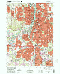
1996 Map of Grand Rapids West
USGS Topo · Published 1999About this map
The Grand River carves a deep path through the urban heart of Grand Rapids, dividing a landscape dense with mid-century development and historical institutions. This era shows the city and its neighbors—Walker, Wyoming, and Grandville—at a point of mature industrial and residential expansion. The map is particularly notable for its concentration of spiritual and educational landmarks, from the St Andrews Cemetery and Greenwood Cemetery to the campuses of Aquinas College and Calvin College.
Find a feature on this map
157 named features on this map. Tap any name to fly to it.
Don’t see what you’re looking for? This feature index may not catch every label — zoom into the map to look around manually.
Map Details
Editions of this 1996 Grand Rapids West Map
This is the sole edition of this map. No revisions or reprints were ever made.
Other maps of this area

1914 · Grand Rapids
USGS Topo · 1:62,500

1918 · Cedar Springs
USGS Topo · 1:62,500

1943 · Cedar Springs
USGS Topo · 1:62,500

1943 · Grand Rapids
USGS Topo · 1:62,500

1945 · Ravenna
USGS Topo · 1:62,500

1954 · Midland
USGS Topo · 1:250,000

1958 · Midland
USGS Topo · 1:250,000

1958 · Grandville
USGS Topo · 1:62,500

1958 · Grandville
USGS Topo · 1:24,000

1958 · Grand Rapids
USGS Topo · 1:250,000