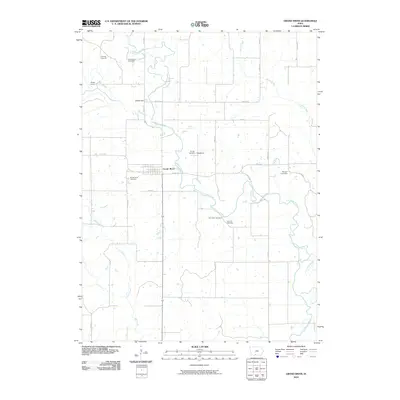
2010 Map of Grand River
USGS Topo · Published 2010About this map
Thompson River meanders through the heart of this Decatur County landscape, defining the character of the small Iowa settlements it passes. The town of Grand River sits near a prominent bend, surrounded by several smaller locales such as Westerville and Woodland. This area is particularly noteworthy for its high density of family and community burial grounds, which offer significant clues for genealogists researching local history. These sites include Old Funk Cemetery, O'Grady Cemetery, and Munyon Cemetery, scattered among the drainages of Elk Creek, Sand Creek, and Long Creek. The presence of Rocky Ford on the western edge suggests an established point of crossing from an earlier era of travel. The map illustrates a strictly rural Iowa environment, dominated by section lines and a grid of county roads that navigate the river's winding course.
Find a feature on this map
29 named features on this map. Tap any name to fly to it.
Don’t see what you’re looking for? This feature index may not catch every label — zoom into the map to look around manually.
Map Details
Editions of this 2010 Grand River Map
This is the sole edition of this map. No revisions or reprints were ever made.
Other maps of this area

1945 · Mount Ayr
USGS Topo · 1:62,500

1945 · Lamoni
USGS Topo · 1:62,500

1947 · Lamoni
USGS Topo · 1:62,500

1947 · Mount Ayr
USGS Topo · 1:62,500

1954 · Centerville
USGS Topo · 1:250,000

1955 · Nebraska City
USGS Topo · 1:250,000

1957 · Nebraska City
USGS Topo · 1:250,000

1957 · Centerville
USGS Topo · 1:250,000

1958 · Centerville
USGS Topo · 1:250,000

1958 · Nebraska City
USGS Topo · 1:250,000