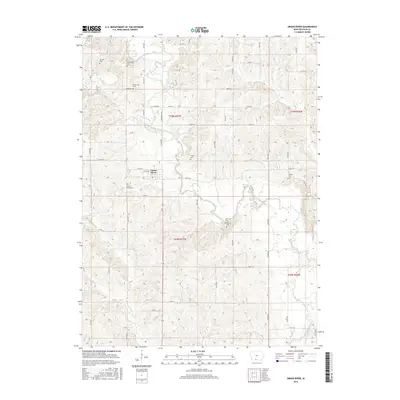
2015 Map of Grand River
USGS Topo · Published 2015About this map
Grand River serves as the primary hub of this rural landscape, situated near the meandering path of the Thompson River. The area is defined by a dense concentration of family and community burial grounds, providing a significant resource for genealogical research. These include the Grand River Cem south of town, and the more secluded Old Funk Cem and Oak Hill Cem to the east. The terrain is deeply carved by several waterways, with Sand Cr, Short Cr, and Elk Cr cutting through the countryside, influencing the layout of the local road network. The map reveals a transition from the town's grid of streets, like W 4th St, to the winding rural routes that follow the ridges and valleys between these many creeks.
Find a feature on this map
54 named features on this map. Tap any name to fly to it.
Don’t see what you’re looking for? This feature index may not catch every label — zoom into the map to look around manually.
Map Details
Editions of this 2015 Grand River Map
This is the sole edition of this map. No revisions or reprints were ever made.
Other maps of this area

1945 · Mount Ayr
USGS Topo · 1:62,500

1945 · Lamoni
USGS Topo · 1:62,500

1947 · Lamoni
USGS Topo · 1:62,500

1947 · Mount Ayr
USGS Topo · 1:62,500

1954 · Centerville
USGS Topo · 1:250,000

1955 · Nebraska City
USGS Topo · 1:250,000

1957 · Nebraska City
USGS Topo · 1:250,000

1957 · Centerville
USGS Topo · 1:250,000

1958 · Centerville
USGS Topo · 1:250,000

1958 · Nebraska City
USGS Topo · 1:250,000