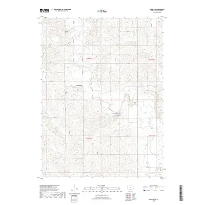
2018 Map of Grand River
USGS Topo · Published 2018About this map
The Thompson River meanders through the heart of this Decatur County landscape, carving a complex network of valleys and ridges around the town of Grand River. This 2018 survey reveals a rural territory defined by section-line roads and numerous family and pioneer burial sites, suggesting a deep-rooted history of settlement along the river's path. Researchers will find a high density of small cemeteries scattered across the townships, from O'Grady Cem in the northwest to Munyon Cem on the eastern hills. The infrastructure is characterized by a grid of local routes like Co Rd R15 and Co Rd J20, which bridge the drainage basins of Elk Cr and Short Cr. The presence of sites such as Old Funk Cem and Oak Hill Cem south of the main river channel indicates the enduring footprint of early agricultural communities within this well-watered Iowa terrain.
Find a feature on this map
55 named features on this map. Tap any name to fly to it.
Don’t see what you’re looking for? This feature index may not catch every label — zoom into the map to look around manually.
Map Details
Editions of this 2018 Grand River Map
This is the sole edition of this map. No revisions or reprints were ever made.
Other maps of this area

1945 · Mount Ayr
USGS Topo · 1:62,500

1945 · Lamoni
USGS Topo · 1:62,500

1947 · Lamoni
USGS Topo · 1:62,500

1947 · Mount Ayr
USGS Topo · 1:62,500

1954 · Centerville
USGS Topo · 1:250,000

1955 · Nebraska City
USGS Topo · 1:250,000

1957 · Nebraska City
USGS Topo · 1:250,000

1957 · Centerville
USGS Topo · 1:250,000

1958 · Centerville
USGS Topo · 1:250,000

1958 · Nebraska City
USGS Topo · 1:250,000