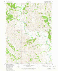
1981 Map of Grand River
USGS Topo · Published 1981About this map
The Thompson River carves a winding path through the rolling hills of Decatur County, anchoring a landscape defined by its agricultural roots and river-bottom timber. Near the center of the sheet, the town of Grand River serves as the primary settlement, while the smaller community of Westerville sits further north along the Sand Creek drainage. The map reveals the imprint of early transportation and industry, specifically the Old Railroad Grade that once connected these rural outposts. Several family-named burial grounds, including O'Grady Cem, Westervelt Cem, and Munyon Cem, provide essential data for genealogists tracing the local homesteaders of Richland and Grand River townships. Public land use is evident at the Sand Creek State Wildlife Area and Shewmaker County Park, preserving the natural character of the river valley.
Find a feature on this map
22 named features on this map. Tap any name to fly to it.
Don’t see what you’re looking for? This feature index may not catch every label — zoom into the map to look around manually.
Map Details
Editions of this 1981 Grand River Map
This is the sole edition of this map. No revisions or reprints were ever made.
Other maps of this area

1945 · Mount Ayr
USGS Topo · 1:62,500

1945 · Lamoni
USGS Topo · 1:62,500

1947 · Lamoni
USGS Topo · 1:62,500

1947 · Mount Ayr
USGS Topo · 1:62,500

1954 · Centerville
USGS Topo · 1:250,000

1955 · Nebraska City
USGS Topo · 1:250,000

1957 · Nebraska City
USGS Topo · 1:250,000

1957 · Centerville
USGS Topo · 1:250,000

1958 · Centerville
USGS Topo · 1:250,000

1958 · Nebraska City
USGS Topo · 1:250,000