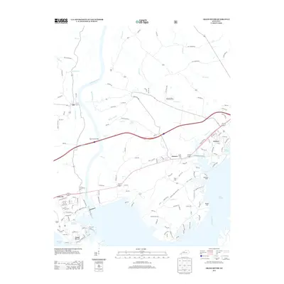
2013 Map of Grand Rivers
USGS Topo · Published 2013About this map
Kuttawa and Grand Rivers occupy the narrow land between two massive water bodies, where the Cumberland River and Kentucky Lake converge. This 2013 survey illustrates a landscape deeply shaped by twentieth-century civil engineering, featuring the massive Barkley Dam Rd and the Ralph Smith Bridge spanning the water. The map provides significant detail for genealogists, marking family-named sites like Peek Cem and Chestnut Oak Cem, alongside industrial and state footprints such as the Kentucky State Penitentiary Farm. Small settlements like Suwanee and Lake City are connected by a network of local roads and the corridor of the Old I C G RR Rd, reflecting the region's transition from a railroad-dependent economy to one centered on the recreation and utility of Lake Barkley. Notable terrain features like Buzzard Rock and Money Cliff stand above the eastern shoreline, marking the original topography of the river valley.
Find a feature on this map
138 named features on this map. Tap any name to fly to it.
Don’t see what you’re looking for? This feature index may not catch every label — zoom into the map to look around manually.
Map Details
Editions of this 2013 Grand Rivers Map
This is the sole edition of this map. No revisions or reprints were ever made.
Other maps of this area

1928 · Eddyville
USGS Topo · 1:48,000

1929 · Smithland
USGS Topo · 1:62,500

1931 · Eddyville
USGS Topo · 1:62,500

1936 · Eddyville
USGS Topo · 1:48,000

1936 · Mont
USGS Topo · 1:24,000

1936 · Grand Rivers
USGS Topo · 1:24,000

1936 · Smithland
USGS Topo · 1:48,000

1936 · Benton
USGS Topo · 1:48,000

1936 · Birmingham
USGS Topo · 1:24,000

1936 · Golden Pond
USGS Topo · 1:48,000