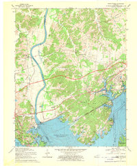
1967 Map of Grand Rivers
USGS Topo · Published 1970About this map
Barkley Dam stands as the centerpiece of this mid-century landscape, regulating the Cumberland River and defining the northern reach of Lake Barkley. The map details the transition of the region into a major recreational and industrial hub, showing the Land Between the Lakes national recreation area and the infrastructure of the Illinois Central Railroad through Grand Rivers and Gravel Switch. To the north, the Kentucky State Penitentiary Farm occupies a significant tract of land near the river bend.
Find a feature on this map
48 named features on this map. Tap any name to fly to it.
Don’t see what you’re looking for? This feature index may not catch every label — zoom into the map to look around manually.
Map Details
Editions of this 1967 Grand Rivers Map
This is the sole edition of this map. No revisions or reprints were ever made.
Other maps of this area

1928 · Eddyville
USGS Topo · 1:48,000

1929 · Smithland
USGS Topo · 1:62,500

1931 · Eddyville
USGS Topo · 1:62,500

1936 · Eddyville
USGS Topo · 1:48,000

1936 · Mont
USGS Topo · 1:24,000

1936 · Grand Rivers
USGS Topo · 1:24,000

1936 · Smithland
USGS Topo · 1:48,000

1936 · Benton
USGS Topo · 1:48,000

1936 · Birmingham
USGS Topo · 1:24,000

1936 · Golden Pond
USGS Topo · 1:48,000