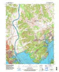
1993 Map of Grand Rivers
USGS Topo · Published 1996About this map
The massive Barkley Dam and its resulting reservoir, Lake Barkley, dominate this landscape at the narrow strip of land separating the Cumberland and Tennessee river systems. In this late twentieth-century revision, the town of Grand Rivers sits at the northern gateway to the Land Between the Lakes recreation area. The topography reveals a complex network of waterways and drainage, including Cumberland River, Kentucky Lake, and numerous sloughs like Baldwin Slough and Gray Slough. Institutional development is prominent in the northern hills at the Western Kentucky Correctional Complex, while the town of Kuttawa anchors the eastern edge of the map. Traces of older communities like Iuka and Suwanee persist alongside modern infrastructure, including a powerplant and various boat ramps that reflect the region's shift toward a hydroelectric and tourism-based economy.
Find a feature on this map
40 named features on this map. Tap any name to fly to it.
Don’t see what you’re looking for? This feature index may not catch every label — zoom into the map to look around manually.
Map Details
Editions of this 1993 Grand Rivers Map
This is the sole edition of this map. No revisions or reprints were ever made.
Other maps of this area

1928 · Eddyville
USGS Topo · 1:48,000

1929 · Smithland
USGS Topo · 1:62,500

1931 · Eddyville
USGS Topo · 1:62,500

1936 · Eddyville
USGS Topo · 1:48,000

1936 · Mont
USGS Topo · 1:24,000

1936 · Grand Rivers
USGS Topo · 1:24,000

1936 · Smithland
USGS Topo · 1:48,000

1936 · Benton
USGS Topo · 1:48,000

1936 · Birmingham
USGS Topo · 1:24,000

1936 · Golden Pond
USGS Topo · 1:48,000