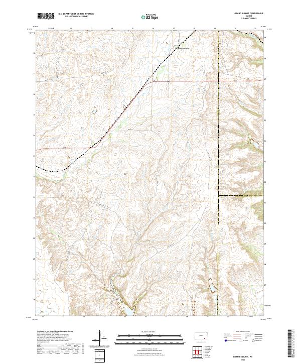
2022 Map of Grand Summit
USGS Topo · Published 2022About this map
Grand Summit anchors the high prairie where the borders of Cowley, Elk, and Chautauqua counties meet. This 2022 survey illustrates a landscape defined by ranching and deep drainages, where winding tracks like Priv Ranch Rd navigate a terrain carved by the waters of Cedar Cr and Otter Cr. The map captures the intersection of rural infrastructure and natural hydrology, including the small northern drainage of Schrader Br and the eastward flow of Spring Cr. This area is characterized by its isolation and the persistence of the original Public Land Survey System grid, which still dictates the placement of routes such as 72nd Rd and 333rd Rd. The sparse settlement pattern reflects the enduring agricultural character of the southeastern Kansas hills.
Find a feature on this map
19 named features on this map. Tap any name to fly to it.
Don’t see what you’re looking for? This feature index may not catch every label — zoom into the map to look around manually.
Map Details
Editions of this 2022 Grand Summit Map
This is the sole edition of this map. No revisions or reprints were ever made.
Other maps of this area

1885 · Sedan
USGS Topo · 1:125,000

1889 · Burden
USGS Topo · 1:125,000

1889 · Sedan
USGS Topo · 1:125,000

1955 · Wichita
USGS Topo · 1:250,000

1958 · Wichita
USGS Topo · 1:250,000

1962 · Grand Summit
USGS Topo · 1:24,000

1962 · Dexter
USGS Topo · 1:24,000
1962 · Cloverdale
USGS Topo · 1:24,000
1962 · Dexter NE
USGS Topo · 1:24,000
1962 · Grenola
USGS Topo · 1:24,000