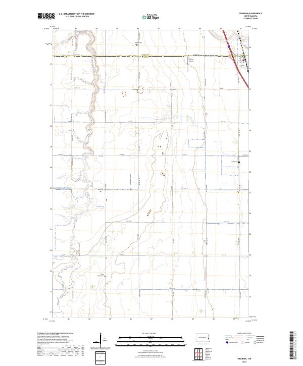
2024 Map of Grandin
USGS Topo · Published 2024About this map
The South Branch Elm River meanders through this agricultural landscape along the border of Traill and Cass counties. The terrain is defined by the rigid grid of the Public Land Survey System, with section lines marked by roads such as 162nd Ave SE and 12th St SE. This survey captures the rural character of the Red River Valley, where small, family-associated landmarks serve as the primary anchors of local history.
Find a feature on this map
33 named features on this map. Tap any name to fly to it.
Don’t see what you’re looking for? This feature index may not catch every label — zoom into the map to look around manually.
Map Details
Editions of this 2024 Grandin Map
This is the sole edition of this map. No revisions or reprints were ever made.
Other maps of this area

1918 · Kelso
USGS Topo · 1:62,500

1918 · Hendrum
USGS Topo · 1:62,500

1943 · Kelso
USGS Topo · 1:62,500

1952 · Grand Forks
USGS Topo · 1:250,000

1956 · Grand Forks
USGS Topo · 1:250,000
1963 · Argusville
USGS Topo · 1:24,000

1963 · Gardner
USGS Topo · 1:24,000

1963 · Kelso
USGS Topo · 1:24,000

1963 · Halstad SW
USGS Topo · 1:24,000

1966 · Grand Forks
USGS Topo · 1:250,000