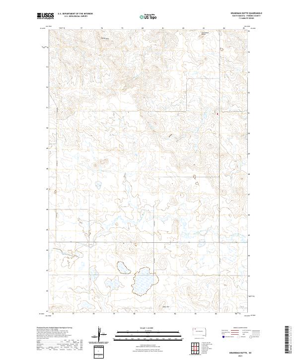
2021 Map of Grandmas Butte
USGS Topo · Published 2021About this map
Grandmas Butte serves as a prominent landmark in this section of Perkins County, anchoring a landscape defined by rolling prairie and intermittent drainage systems. The hydrography of the region is dominated by Thunder Butte Creek, which flows across the southern portion of the quadrangle, while Murphy Cr and Snake Cr carve through the northern terrain. This area of South Dakota maintains a traditional township and range grid, evidenced by the prominent section lines and the network of section-line roads like Date Rd and 170th Ave. Elevation markers such as the Rocky Hills and Wolf Hill provide essential geographic context for this sparsely populated ranching country. The presence of Divide Rd along the western edge suggests a natural height of land separating local watersheds in the High Plains.
Find a feature on this map
16 named features on this map. Tap any name to fly to it.
Don’t see what you’re looking for? This feature index may not catch every label — zoom into the map to look around manually.
Map Details
Editions of this 2021 Grandmas Butte Map
This is the sole edition of this map. No revisions or reprints were ever made.
Other maps of this area

1954 · Lemmon
USGS Topo · 1:250,000

1957 · Lemmon
USGS Topo · 1:250,000

1983 · Grandmas Butte
USGS Topo · 1:24,000

1983 · Prairie City NE
USGS Topo · 1:24,000

1983 · Square Top Butte
USGS Topo · 1:24,000

1983 · Sorum NE
USGS Topo · 1:24,000

1983 · Cole Dam
USGS Topo · 1:24,000

1983 · Date NE
USGS Topo · 1:24,000

1983 · Little Nasty Creek
USGS Topo · 1:24,000

1983 · Daviston
USGS Topo · 1:24,000