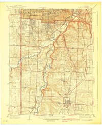
1939 Map of Grandview
USGS Topo · Published 1939About this map
Blue River meanders through the heart of southern Kansas City, carving a path through a landscape transitioning from suburban expansion to rural township at the end of the 1930s. The map reveals the intricate social and physical infrastructure of Washington township, where established settlements like Grandview and Hickman Mills are anchored by landmarks such as Ruskin High Sch and St Catherines Ch. The era's recreational culture is remarkably visible, with a dense corridor of sporting grounds including Ivanhoe Golf Club and St Andrews Golf Club nestled near the southern edge of Swope Park.
Find a feature on this map
50 named features on this map. Tap any name to fly to it.
Don’t see what you’re looking for? This feature index may not catch every label — zoom into the map to look around manually.
Map Details
Editions of this 1939 Grandview Map
2 editions found

Other maps of this area

1887 · Harrisonville
USGS Topo · 1:125,000

1887 · Olathe
USGS Topo · 1:125,000

1890 · Kansas City
USGS Topo · 1:125,000

1892 · Harrisonville
USGS Topo · 1:125,000

1893 · Olathe
USGS Topo · 1:125,000

1894 · Kansas City
USGS Topo · 1:125,000

1894 · Harrisonville
USGS Topo · 1:125,000

1894 · Independence
USGS Topo · 1:125,000

1934 · Independence
USGS Topo · 1:24,000

1934 · Grandview
USGS Topo · 1:24,000