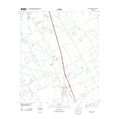
2012 Map of Grandview
USGS Topo · Published 2012About this map
Grandview and the surrounding Johnson County landscape are defined by a network of north-flowing creeks, including the N Fork Chambers Cr and S Fork Chambers Cr, which create a complex drainage pattern across the prairie. The settlement of Antioch remains a distinct marker along the central corridor, while rural aviation is notably prevalent, with facilities such as Luscombe Acres Airport and the Block Ranch Airport interspersed among the farmsteads.
Find a feature on this map
95 named features on this map. Tap any name to fly to it.
Don’t see what you’re looking for? This feature index may not catch every label — zoom into the map to look around manually.
Map Details
Editions of this 2012 Grandview Map
This is the sole edition of this map. No revisions or reprints were ever made.
Other maps of this area

1891 · Cleburne
USGS Topo · 1:125,000

1894 · Cleburne
USGS Topo · 1:125,000

1927 · Blum
USGS Topo · 1:62,500

1954 · Dallas
USGS Topo · 1:250,000

1958 · Dallas
USGS Topo · 1:250,000

1960 · Keene
USGS Topo · 1:24,000

1960 · Cleburne East
USGS Topo · 1:24,000
1961 · Maypearl
USGS Topo · 1:24,000

1961 · Alvarado
USGS Topo · 1:24,000
1961 · Venus
USGS Topo · 1:24,000