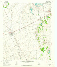
1961 Map of Venus
USGS Topo · Published 1963About this map
Venus sits at the western edge of this 1961 landscape, established as a railroad junction where the Missouri Pacific and the Gulf Colorado and Santa Fe lines intersect. The rural character of the Johnson and Ellis county line is evident in the sprawling network of waterways like Soap Creek and Cottonwood Creek that drain toward the east. To the northeast, Midlothian is clearly defined, connected to the surrounding countryside by the Southern Pacific railroad and early iterations of highways 67 and 287.
Find a feature on this map
29 named features on this map. Tap any name to fly to it.
Don’t see what you’re looking for? This feature index may not catch every label — zoom into the map to look around manually.
Map Details
Editions of this 1961 Venus Map
4 editions found
Other maps of this area

1891 · Dallas
USGS Topo · 1:125,000

1891 · Cleburne
USGS Topo · 1:125,000

1893 · Dallas
USGS Topo · 1:125,000

1894 · Cleburne
USGS Topo · 1:125,000

1894 · Fort Worth
USGS Topo · 1:125,000

1954 · Dallas
USGS Topo · 1:250,000

1958 · Dallas
USGS Topo · 1:250,000

1959 · Cedar Hill
USGS Topo · 1:24,000

1959 · Britton
USGS Topo · 1:24,000

1959 · Mansfield
USGS Topo · 1:24,000