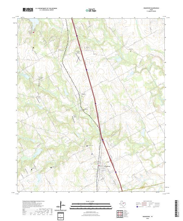
2022 Map of Grandview
USGS Topo · Published 2022About this map
Grandview serves as the focal point of this Johnson County landscape, where the intersection of FM 916 and 3rd St anchors a community defined by its proximity to the interstate corridor. The drainage of S Fork Chambers Cr and its various tributaries, including Middle Fork S Fork Chambers Cr and Rock Tank Cr, carve subtle paths through the terrain. A notable concentration of small, private airfields such as Luscombe Acres Airport and Drennan Airport suggests a local economy and lifestyle integrated with general aviation.
Find a feature on this map
91 named features on this map. Tap any name to fly to it.
Don’t see what you’re looking for? This feature index may not catch every label — zoom into the map to look around manually.
Map Details
Editions of this 2022 Grandview Map
This is the sole edition of this map. No revisions or reprints were ever made.
Other maps of this area

1891 · Cleburne
USGS Topo · 1:125,000

1894 · Cleburne
USGS Topo · 1:125,000

1927 · Blum
USGS Topo · 1:62,500

1954 · Dallas
USGS Topo · 1:250,000

1958 · Dallas
USGS Topo · 1:250,000

1960 · Keene
USGS Topo · 1:24,000

1960 · Cleburne East
USGS Topo · 1:24,000
1961 · Maypearl
USGS Topo · 1:24,000

1961 · Alvarado
USGS Topo · 1:24,000
1961 · Venus
USGS Topo · 1:24,000