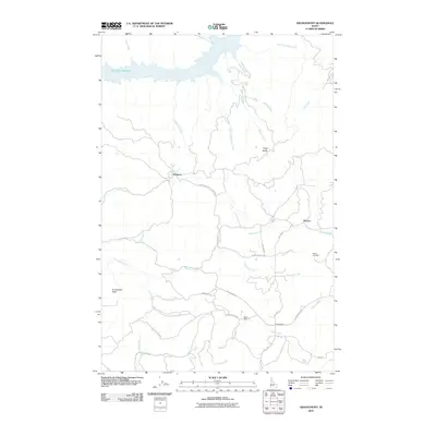
2010 Map of Grangemont
USGS Topo · Published 2010About this map
Dworshak Reservoir dominates the northern reaches of this Idaho landscape, where the waters meet a complex network of drainages including O'Neil Creek and White Creek. The settlement of Grangemont serves as a focal point in the south, connected by a network of timber and mountain roads like Grangemont Rd and State Rd. The presence of the Band Mill near Old Deer Creek Rd reflects the area's industrial ties to the surrounding forest.
Find a feature on this map
30 named features on this map. Tap any name to fly to it.
Don’t see what you’re looking for? This feature index may not catch every label — zoom into the map to look around manually.
Map Details
Editions of this 2010 Grangemont Map
This is the sole edition of this map. No revisions or reprints were ever made.
Other maps of this area

1923 · Washington Creek
USGS Topo · 1:125,000

1924 · Kamiah
USGS Topo · 1:125,000

1924 · Weippe
USGS Topo · 1:125,000

1938 · Headquarters
USGS Topo · 1:48,000

1944 · Headquarters
USGS Topo · 1:62,500

1955 · Pullman
USGS Topo · 1:250,000

1956 · Hamilton
USGS Topo · 1:250,000

1958 · Pullman
USGS Topo · 1:250,000

1959 · Hamilton
USGS Topo · 1:250,000

1960 · Hamilton
USGS Topo · 1:250,000