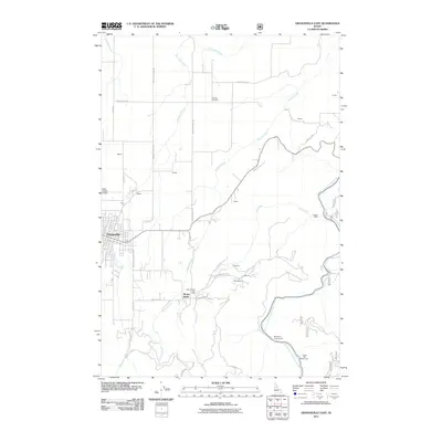
2011 Map of Grangeville East
USGS Topo · Published 2011About this map
Grangeville serves as the primary hub in this Idaho landscape, where the town's street grid meets the winding drainages of Threemile Creek and Butcher Creek. The map records a transition from established municipal areas to more isolated landmarks, including the historic site of the Idaho County Poor Farm and the Fairview Cemetery to the north. These features reflect the long-standing community infrastructure of Idaho County, preserved alongside older transportation routes like the Old Stites Stage Rd.
Find a feature on this map
40 named features on this map. Tap any name to fly to it.
Don’t see what you’re looking for? This feature index may not catch every label — zoom into the map to look around manually.
Map Details
Editions of this 2011 Grangeville East Map
This is the sole edition of this map. No revisions or reprints were ever made.
Other maps of this area

1924 · Kamiah
USGS Topo · 1:125,000

1924 · Weippe
USGS Topo · 1:125,000

1931 · Buffalo Hump
USGS Topo · 1:125,000

1934 · Buffalo Hump
USGS Topo · 1:125,000

1955 · Pullman
USGS Topo · 1:250,000

1955 · Grangeville
USGS Topo · 1:250,000

1956 · Elk City
USGS Topo · 1:250,000

1956 · Hamilton
USGS Topo · 1:250,000

1958 · Pullman
USGS Topo · 1:250,000

1959 · Grangeville
USGS Topo · 1:250,000