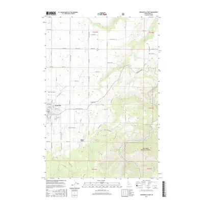
2017 Map of Grangeville East
USGS Topo · Published 2017About this map
The plateau community of Grangeville serves as the focal point of this 2017 survey, where the Camas Prairie meets the rising timber of the Nez Perce National Forest. The landscape transitions from the grid of the city to the steep breaks of Luke's Gulch and the winding descent of the Harpster Grade Rd. The importance of early transit is evident in routes like Old Stites Stage Rd, which historically connected these upland settlements to the river canyons below. To the southeast, the small settlement of Mount Idaho sits near the headwaters of Mill Cr, marking one of the county's earliest pioneer sites. The rugged southern terrain is defined by the South Fork Clearwater River, which cuts through the deep drainages of the national forest. Local history is further preserved at the Fairview Cem and the Idaho County Airport, reflecting the region's long-standing role as a central hub for Idaho County's agriculture and aviation.
Find a feature on this map
104 named features on this map. Tap any name to fly to it.
Don’t see what you’re looking for? This feature index may not catch every label — zoom into the map to look around manually.
Map Details
Editions of this 2017 Grangeville East Map
This is the sole edition of this map. No revisions or reprints were ever made.
Other maps of this area

1924 · Kamiah
USGS Topo · 1:125,000

1924 · Weippe
USGS Topo · 1:125,000

1931 · Buffalo Hump
USGS Topo · 1:125,000

1934 · Buffalo Hump
USGS Topo · 1:125,000

1955 · Pullman
USGS Topo · 1:250,000

1955 · Grangeville
USGS Topo · 1:250,000

1956 · Elk City
USGS Topo · 1:250,000

1956 · Hamilton
USGS Topo · 1:250,000

1958 · Pullman
USGS Topo · 1:250,000

1959 · Grangeville
USGS Topo · 1:250,000