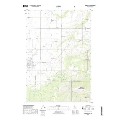
2020 Map of Grangeville East
USGS Topo · Published 2020About this map
Grangeville and the neighboring settlement of Mount Idaho anchor this landscape where the Camas Prairie meets the foothills of the Nez Perce National Forest. The map documents a complex network of local roads and historical routes, including the Old Stites Stage Rd and Harpster Grade Rd, which speak to the region's long-standing role as a transit hub. In the western portion, the Idaho County Courthouse stands as a central landmark for the county seat, while the Idaho County Airport occupies the northern edge of the town. The terrain is defined by the steep drainages of Threemile Cr, Butcher Cr, and Mill Cr, all flowing toward the South Fork Clearwater River which cuts through the southeastern corner. This survey details the transition from organized town grids to the rugged, timbered reaches of the national forest.
Find a feature on this map
79 named features on this map. Tap any name to fly to it.
Don’t see what you’re looking for? This feature index may not catch every label — zoom into the map to look around manually.
Map Details
Editions of this 2020 Grangeville East Map
This is the sole edition of this map. No revisions or reprints were ever made.
Other maps of this area

1924 · Kamiah
USGS Topo · 1:125,000

1924 · Weippe
USGS Topo · 1:125,000

1931 · Buffalo Hump
USGS Topo · 1:125,000

1934 · Buffalo Hump
USGS Topo · 1:125,000

1955 · Pullman
USGS Topo · 1:250,000

1955 · Grangeville
USGS Topo · 1:250,000

1956 · Elk City
USGS Topo · 1:250,000

1956 · Hamilton
USGS Topo · 1:250,000

1958 · Pullman
USGS Topo · 1:250,000

1959 · Grangeville
USGS Topo · 1:250,000