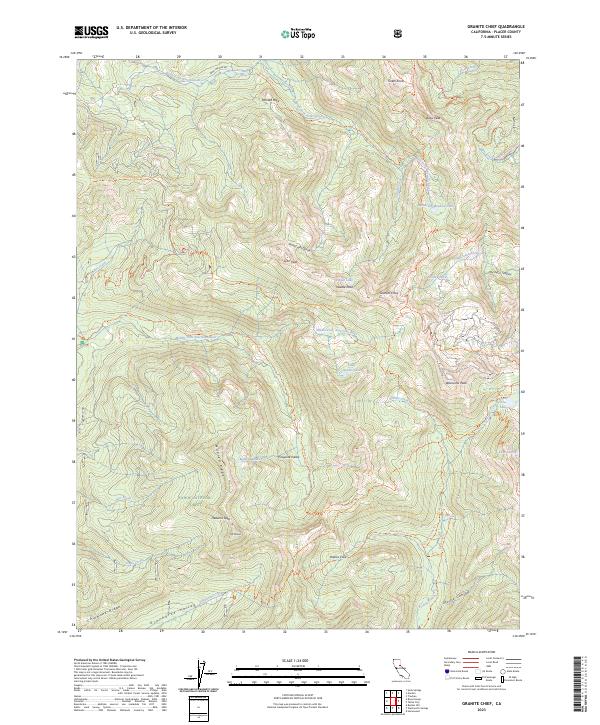
2023 Map of Granite Chief
USGS Topo · Published 2023About this map
Olympic Valley sits at the eastern edge of this high-altitude landscape, where the Sierra Nevada divide is defined by a series of peaks including Tinker Knob, Granite Chief, and Washeshu Peak. The area is characterized by a dense network of iconic long-distance trails, such as the Pacific Crest National Scenic Trl, the Western States Trl, and the Tevis Cup Trl, which navigate the steep drainages of the North Fork American River and the Middle Fork American River. These river systems are fed by numerous high-elevation water bodies like Shirley Lake, Needle Lake, and the cluster known as Five Lakes. The topographic complexity is evident along the Forest Hill Divide, separating the major river forks. Within the Granite Chief Wilderness and Tahoe National Forest, the map records numerous named ridges and canyons, such as Mildred Ridge and Grouse Canyon, reflecting a landscape preserved for its natural state and recreational significance.
Find a feature on this map
60 named features on this map. Tap any name to fly to it.
Don’t see what you’re looking for? This feature index may not catch every label — zoom into the map to look around manually.
Map Details
Editions of this 2023 Granite Chief Map
This is the sole edition of this map. No revisions or reprints were ever made.
Other maps of this area

1891 · Truckee
USGS Topo · 1:125,000

1893 · Truckee
USGS Topo · 1:125,000

1895 · Truckee
USGS Topo · 1:125,000

1932 · Truckee
USGS Topo · 1:96,000

1940 · Truckee
USGS Topo · 1:125,000

1953 · Granite Chief
USGS Topo · 1:24,000
1953 · Royal Gorge
USGS Topo · 1:24,000
1953 · Wentworth Springs
USGS Topo · 1:24,000
1953 · Bunker Hill
USGS Topo · 1:24,000

1953 · Granite Chief
USGS Topo · 1:62,500