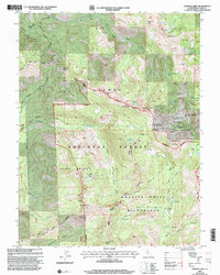
2000 Map of Granite Chief
USGS Topo · Published 2003About this map
Granite Chief Wilderness and the surrounding reaches of Tahoe National Forest dominate this high-elevation terrain in Placer County. Long-distance paths such as the Tevis Cup Trail and the Pacific Crest National Scenic Trail traverse the ridgelines, marking the region's importance for endurance trekking and historic migration. The presence of the Watson Monument Emigrant Pass Marker at the wilderness boundary indicates the historical significance of these passes for early travelers crossing the Sierra Nevada. High peaks like Granite Chief, Tinker Knob, and Mount Mildred define the watershed, feeding the North Fork American River and smaller systems like Rice Creek and Whisky Creek. The eastern edge reveals the development of Squaw Valley, contrasting the preserved wild lands of the Game Refuge to the west.
Find a feature on this map
45 named features on this map. Tap any name to fly to it.
Don’t see what you’re looking for? This feature index may not catch every label — zoom into the map to look around manually.
Map Details
Editions of this 2000 Granite Chief Map
This is the sole edition of this map. No revisions or reprints were ever made.
Other maps of this area

1891 · Truckee
USGS Topo · 1:125,000

1893 · Truckee
USGS Topo · 1:125,000

1895 · Truckee
USGS Topo · 1:125,000

1932 · Truckee
USGS Topo · 1:96,000

1940 · Truckee
USGS Topo · 1:125,000

1953 · Granite Chief
USGS Topo · 1:24,000
1953 · Royal Gorge
USGS Topo · 1:24,000
1953 · Wentworth Springs
USGS Topo · 1:24,000
1953 · Bunker Hill
USGS Topo · 1:24,000

1953 · Granite Chief
USGS Topo · 1:62,500