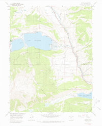
1967 Map of Granite
USGS Topo · Published 1972About this map
Granite sits as a critical point of intersection on this 1960s survey, where the Arkansas River corridor meets the Denver and Rio Grande Western RR. This high-elevation landscape is defined by the extraction of resources and the management of water, featuring extensive placer mines and the Columbine Mine. The boundary between Lake Co and Chaffee Co cuts through the rugged terrain of the San Isabel National Forest, which is crisscrossed by historic routes like the Main Range Trail (Pack).
Find a feature on this map
36 named features on this map. Tap any name to fly to it.
Don’t see what you’re looking for? This feature index may not catch every label — zoom into the map to look around manually.
Map Details
Editions of this 1967 Granite Map
3 editions found
Other maps of this area

1889 · Leadville
USGS Topo · 1:125,000

1891 · Leadville
USGS Topo · 1:125,000

1935 · Mount Elbert
USGS Topo · 1:62,500

1938 · Mount Elbert
USGS Topo · 1:62,500

1939 · Mount Elbert
USGS Topo · 1:62,500

1942 · Leadville
USGS Topo · 1:125,000

1955 · Buena Vista
USGS Topo · 1:62,500

1955 · Mount Harvard
USGS Topo · 1:62,500

1956 · Montrose
USGS Topo · 1:250,000

1957 · Leadville
USGS Topo · 1:250,000