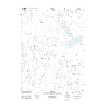
2012 Map of Graniteville
USGS Topo · Published 2012About this map
Graniteville anchors this survey of the Sierra Nevada highlands, where the industrial legacy of California’s hydraulic and hard-rock mining era is etched into the landscape. The map details a complex water management system essential for high-elevation operations, featuring the Bowman Tunnel and Clear Creek Tunnel alongside massive catchments like Bowman Lake and the Weaver Reservoir. Evidence of early processing sites and mountain camps is preserved through labels like the Old Condon Mill and the settlement of Gaston, which sits along the Gaston Rd near Gaston Ridge. High mountain meadows and flats, such as Loney Meadow and Murphy Flat, break the steep drainage patterns of the Middle Yuba River and its numerous tributaries. This 2012 update documents the transition of these historic industrial sites into recreation hubs, noting multiple campgrounds like McMurray Campground and Carr-Feeley Campground that now occupy the rugged terrain once defined by mills and mining claims.
Find a feature on this map
64 named features on this map. Tap any name to fly to it.
Don’t see what you’re looking for? This feature index may not catch every label — zoom into the map to look around manually.
Map Details
Editions of this 2012 Graniteville Map
This is the sole edition of this map. No revisions or reprints were ever made.
Other maps of this area

1891 · Downieville
USGS Topo · 1:125,000

1891 · Colfax
USGS Topo · 1:125,000

1892 · Colfax
USGS Topo · 1:125,000

1893 · Downieville
USGS Topo · 1:125,000

1894 · Colfax
USGS Topo · 1:125,000

1895 · Downieville
USGS Topo · 1:125,000

1896 · Downieville
USGS Topo · 1:125,000

1897 · Downieville
USGS Topo · 1:125,000

1898 · Colfax
USGS Topo · 1:125,000

1900 · Colfax
USGS Topo · 1:125,000