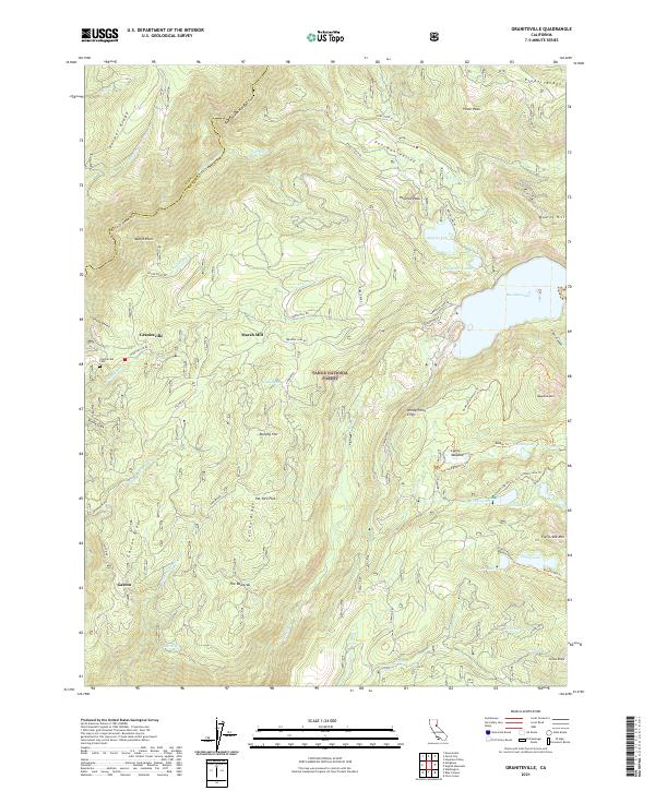
2021 Map of Graniteville
USGS Topo · Published 2021About this map
Graniteville stands as a focal point in this high Sierra landscape, situated near the headwaters of Poorman Cr within the Tahoe National Forest. The map documents a geography defined by the legacy of early industry and mountain travel, where names like Marsh Mill and the Graniteville Cem hint at the area's gold-rush era heritage. Significant changes in elevation are marked by prominent heights such as Pyramid Peak and Bowman Mtn, while the boundary between Sierra and Nevada counties follows the winding course of the Middle Yuba River. Numerous high-altitude water bodies, including Bowman Lake and the Lindsey Lakes, dominate the eastern portion of the quadrangle. The network of forest routes and trails, such as the Bowman Mountain Trl and Ancho Mine Rd, illustrates the continued importance of access to these remote flats and ridges like Pat Yore Flat and Celina Ridge.
Find a feature on this map
77 named features on this map. Tap any name to fly to it.
Don’t see what you’re looking for? This feature index may not catch every label — zoom into the map to look around manually.
Map Details
Editions of this 2021 Graniteville Map
This is the sole edition of this map. No revisions or reprints were ever made.
Other maps of this area

1891 · Downieville
USGS Topo · 1:125,000

1891 · Colfax
USGS Topo · 1:125,000

1892 · Colfax
USGS Topo · 1:125,000

1893 · Downieville
USGS Topo · 1:125,000

1894 · Colfax
USGS Topo · 1:125,000

1895 · Downieville
USGS Topo · 1:125,000

1896 · Downieville
USGS Topo · 1:125,000

1897 · Downieville
USGS Topo · 1:125,000

1898 · Colfax
USGS Topo · 1:125,000

1900 · Colfax
USGS Topo · 1:125,000