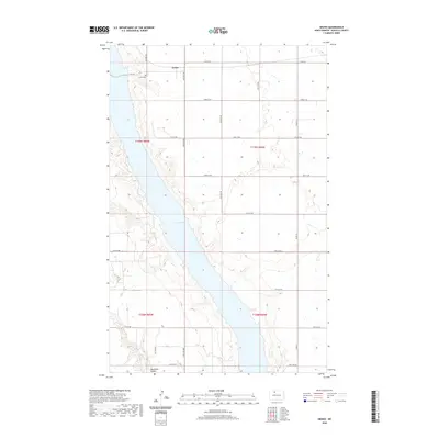
2020 Map of Grano
USGS Topo · Published 2020About this map
Lake Darling dominates this Renville County landscape, winding through the valley as the central topographical feature of the region. The small settlement of Grano sits on the upland plain to the north, characterized by its grid of rural routes including Co Rd 26 and 40th Ave NW. This survey documents a quiet prairie geography defined by the sharp transition between the steep banks of the coulees and the level agricultural sections that surround them. Genealogists and local historians can pinpoint the location of Grano Cem, situated just west of the townsite on the bluffs overlooking the water. In the southern portion of the sheet, the waterway of Mackobee Coulee joins the larger basin, illustrating the drainage patterns that have shaped this portion of North Dakota.
Find a feature on this map
22 named features on this map. Tap any name to fly to it.
Don’t see what you’re looking for? This feature index may not catch every label — zoom into the map to look around manually.
Map Details
Editions of this 2020 Grano Map
This is the sole edition of this map. No revisions or reprints were ever made.
Other maps of this area

1948 · Lansford
USGS Topo · 1:62,500

1948 · Burlington
USGS Topo · 1:62,500

1948 · Lansford SW
USGS Topo · 1:24,000

1949 · Burlington NW
USGS Topo · 1:24,000

1949 · Lansford NW
USGS Topo · 1:24,000

1949 · Lansford SW
USGS Topo · 1:24,000

1949 · Carpio NE
USGS Topo · 1:24,000

1949 · Carpio
USGS Topo · 1:24,000

1949 · Grano SW
USGS Topo · 1:24,000

1949 · Greene
USGS Topo · 1:24,000