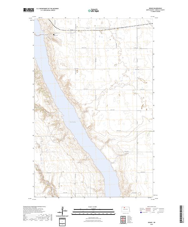
2024 Map of Grano
USGS Topo · Published 2024About this map
Grano is situated in the north-central prairie landscape of Renville County, where the grid of agricultural section roads meets the managed waters of the Souris River valley. This 2024 edition shows a landscape defined by the expansive Lake Darling, which fills the valley floor within the boundaries of the Upper Souris National Wildlife Refuge. The settlement of Grano sits on the upland plateau just east of the river valley, connected to the surrounding countryside by Co Rd 26 and a network of gravel section lines like 82nd St NW. Genealogists and local historians can locate the Grano Cem perched on the bluffs overlooking the refuge, a landmark that remains a permanent fixture as the surrounding agricultural patterns shift between townships t159n r85w and t159n r84w.
Find a feature on this map
22 named features on this map. Tap any name to fly to it.
Don’t see what you’re looking for? This feature index may not catch every label — zoom into the map to look around manually.
Map Details
Editions of this 2024 Grano Map
This is the sole edition of this map. No revisions or reprints were ever made.
Other maps of this area

1948 · Lansford
USGS Topo · 1:62,500

1948 · Burlington
USGS Topo · 1:62,500

1948 · Lansford SW
USGS Topo · 1:24,000

1949 · Burlington NW
USGS Topo · 1:24,000

1949 · Lansford NW
USGS Topo · 1:24,000

1949 · Lansford SW
USGS Topo · 1:24,000

1949 · Carpio NE
USGS Topo · 1:24,000

1949 · Carpio
USGS Topo · 1:24,000

1949 · Grano SW
USGS Topo · 1:24,000

1949 · Greene
USGS Topo · 1:24,000