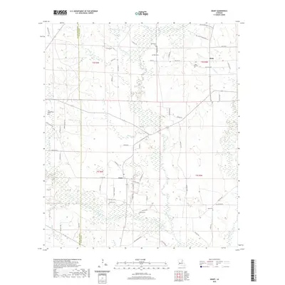
2020 Map of Grant
USGS Topo · Published 2020About this map
The boundary between Beauregard Parish and Allen Parish divides this rural landscape, where the settlements of Grant and Reids are centered within a network of creek drainages and timbered tracts. The terrain is defined by the significant waterways of Whisky Chitto Creek and Sixmile Creek, which are fed by numerous smaller tributaries like Soapstone Cr and Perkins Br. The distribution of rural cemeteries such as Hamilton Cem, Palestine Cem, and Horton Cem suggests a pattern of family-centric settlement that has persisted through the decades. The map reveals an intricate road system often named for local families, including Dick Weldon Rd, Monroe Baggett Rd, and Louis Williams Loop, reflecting the area's deep-rooted local history and genealogical significance in this portion of Louisiana.
Find a feature on this map
67 named features on this map. Tap any name to fly to it.
Don’t see what you’re looking for? This feature index may not catch every label — zoom into the map to look around manually.
Map Details
Editions of this 2020 Grant Map
This is the sole edition of this map. No revisions or reprints were ever made.
Other maps of this area

1935 · Mittie
USGS Topo · 1:31,680

1947 · Steep Gully
USGS Topo · 1:31,680

1947 · Pine Chapel
USGS Topo · 1:31,680

1947 · Elizabeth
USGS Topo · 1:31,680

1947 · Grant
USGS Topo · 1:31,680

1947 · Bundick
USGS Topo · 1:31,680

1947 · Sugartown
USGS Topo · 1:31,680

1947 · Sugrue
USGS Topo · 1:31,680

1947 · Pitkin
USGS Topo · 1:31,680

1948 · Grant
USGS Topo · 1:24,000