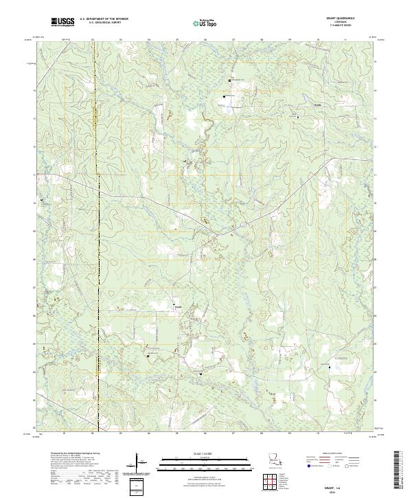
2024 Map of Grant
USGS Topo · Published 2024About this map
Whisky Chitto Creek and its many tributaries, including Indian Branch and Sugar Creek, define the low-lying landscape along the boundary of Beauregard Parish and Allen Parish. This 2024 survey captures a rural Louisiana corridor characterized by family-named landmarks and small, dispersed settlements like Grant and Reids. The density of community burial grounds—including Arkadelphia Cem, Hamilton Cem, and the Old Campground Cem—suggests a deeply rooted local history and long-established family homesteads across the region.
Find a feature on this map
71 named features on this map. Tap any name to fly to it.
Don’t see what you’re looking for? This feature index may not catch every label — zoom into the map to look around manually.
Map Details
Editions of this 2024 Grant Map
This is the sole edition of this map. No revisions or reprints were ever made.
Other maps of this area

1935 · Mittie
USGS Topo · 1:31,680

1947 · Steep Gully
USGS Topo · 1:31,680

1947 · Pine Chapel
USGS Topo · 1:31,680

1947 · Elizabeth
USGS Topo · 1:31,680

1947 · Grant
USGS Topo · 1:31,680

1947 · Bundick
USGS Topo · 1:31,680

1947 · Sugartown
USGS Topo · 1:31,680

1947 · Sugrue
USGS Topo · 1:31,680

1947 · Pitkin
USGS Topo · 1:31,680

1948 · Grant
USGS Topo · 1:24,000